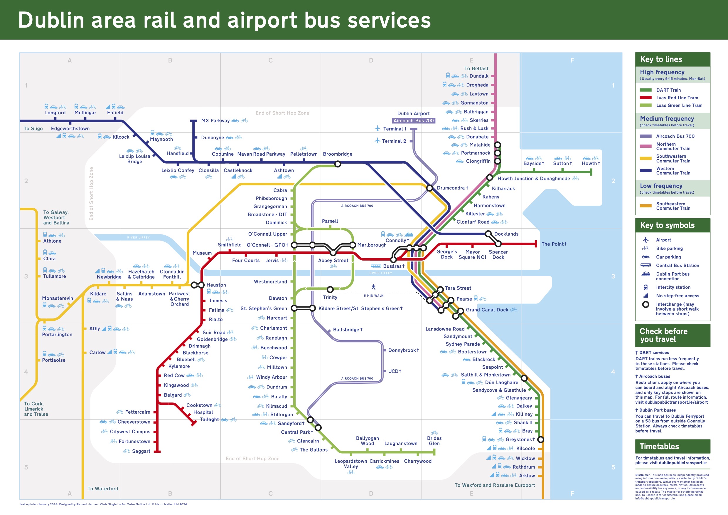
Dublin rail map — DART, Luas and key airport bus routes
Our Dublin train map outlines all the train and tram lines for the Greater Dublin Area (DART, Luas and Commuter services), as well as the key Dublin Airport bus connections.
Unlike other Dublin train maps you’ll find online, this map provides wheelchair accessibility, bike parking and car parking information.
For more information about the zones featured on the map, please see our Leap Cards zones section.
Please note that the PDF contains a station index; the JPG version does not. You are free to use the map for personal use — for commercial use, please contact us to license it.
Using our Dublin train map
Important: This map is a ‘BETA’ version. It is produced independently of Dublin’s transport operators, but using information made publicly available by them. Whilst every effort has been made to avoid inaccuracies, we cannot take any responsibility for any inconvenience arising from its use. If you have any feedback on the map or suggested improvements, we’d love to hear them - feel free to contact us.
You are free to download and use our Dublin rail map for personal use. However, if you wish to use it for commercial use, you will need to license it first — please contact us for details.
The map features the following services:
Luas Red Line
Luas Green Line
DART
Commuter trains (Northern, Western, Southeastern and Southwestern lines)
Key Dublin Airport bus services (Aircoach Route 700 and Dublin Express Route 782)
About our Dublin rail map (and putting DART, Luas, Commuter and Airport bus services all in one place!)
Although there has been something of a rail revival in Dublin in recent years, with a significant expansion of Dublin’s tram network and the the re-opening of commuter rail lines in Dublin, graphic design has failed to keep up! Go to any rail station or tram stop in Dublin and you’ll be struck by the lack of maps highlighting how all the various rail lines integrate with each other. Although route maps for individual services exist, it’s difficult to find a comprehensive, high-quality map of all the rail routes in Dublin.
This contrasts starkly with the abundance of lovingly-designed network maps at stations in London, Paris or Berlin; so a key aim of putting this website together was to make sure it provided a map of Dublin’s rail network which was of a similar standard to the maps found in these European capitals.
With this in mind, Chris Singleton enlisted experienced graphic designer Richard Hart to help him create a new, high-quality rail map for Dublin. The result: a map that shows all rail lines in one place in an easy-to-understand format that wouldn’t be out of place in a major European capital.
The idea is that instead of having to refer to a Luas map, a Dart map, a Commuter rail map and a Dublin airport bus map…you can just look at one document!
A key aim was to include wheelchair accessibility information on the new map — the existing maps are poor in this regard. The new map gives at-a-glance information regarding the suitability of stations for wheelchair users (and other individuals with a mobility impairment). Additionally, the map provides clear information regarding which stations provide bike and car parking — again, something which is not really present on existing maps.
And finally, the map also includes key airport bus stops — this helps visitors to Dublin to switch easily from airport buses onto other modes of transport in the capital.
You can download the rail map as a PDF here.
The map is part of a wider project, to provide a Dublin public transport portal providing information about all types of public transport in the capital.
See also
Dublin trains — a guide to the different types of rail services in Dublin
Dublin trams — all about Dublin’s light rail “Luas” service
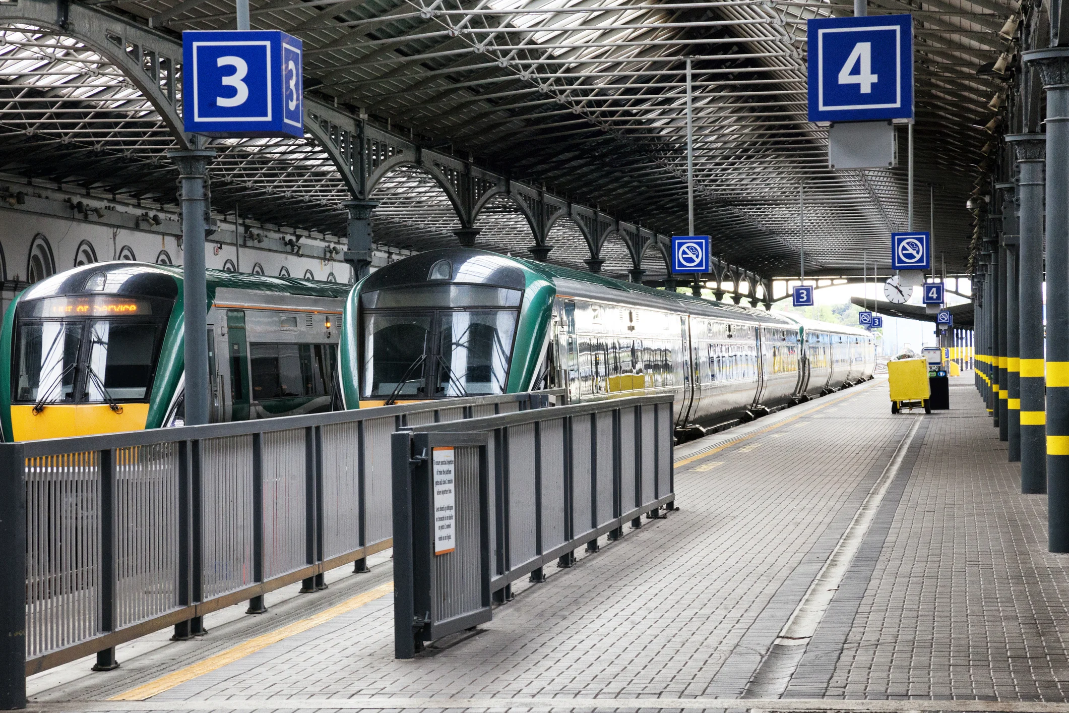
Dublin train stations — a guide to the main intercity and commuter train stations in Dublin
Top ten things to do in Dublin by train or tram